- CCT Public Page
- [CCT Members Area]
Gallery
|
|
|
|
|
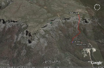
Map of the knuckle from Google Earth. From http://joandben.smugmug.com/
|
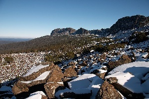
View towards Stacks Bluff from the Knuckle. From http://joandben.smugmug.com/
|
The Knuckle, July 2007. Photo from http://joandben.smugmug.com/
|
|
|
|
|
|
|
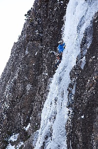
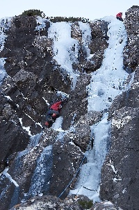
The Knuckle, July 2007. Photo from http://joandben.smugmug.com/
|
The Knuckle, July 2007. Photo from http://joandben.smugmug.com/
|
The Knuckle, July 2007. Photo from http://joandben.smugmug.com/
|
The Knuckle, July 2007. Photo from http://joandben.smugmug.com/
|
|
|
||
|
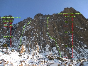
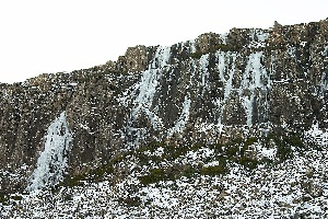
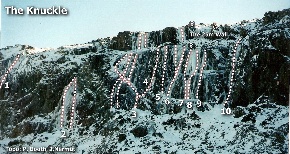
Topo of ice routes on The Knuckle
|
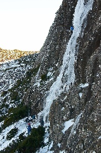
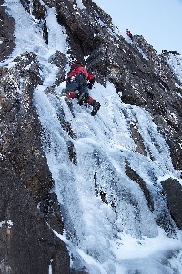
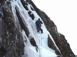
Bill Baxter climbing The Runnel, on the Knuckle.
|
Overview
Content Tools

|
http://www.thesarvo.com is licensed under a
Creative Commons Attribution-Share Alike 2.5 Australia License.
For more details see http://www.thesarvo.com/confluence/display/thesarvo/Copyright |