
Fluted Cape Area
Introduction
The eastern side of South Bruny Island is fringed by spectacular, massive, dolerite sea cliffs, rising up to 200m high. The area is extremely exposed to the wind and waves of the Tasman Sea and access is generally difficult. Two areas have been climbed on to date but there is massive potential for future exploration.
Access
Take the turn off to Adventure Bay (C630) to reach Fluted Cape and the Bruny Stacks access boat ramp. The walking track begins at East Cove, the southern most part of Adventure Bay Beach.
Park entry fees apply and passes are available from the D'Entrcasteaux Visitors Centre at Kettering, or at registration booths at the Neck and the Lighthouse Road (Mable Bay).
Follow the Grass Point track to the open grassland at the end of the point (ignore the first sign you pass on the R to Fluted Cape) before turning back south to climb steeply up past the cliff tops (signposted).
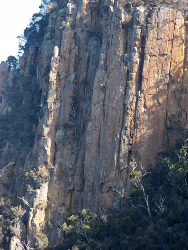
On the way up, heading south and after passing a solitary pillar on the left, there is a steep dirty descent gully about 100m before the big Parched Pillar cliff. The surrounding cliffs are vertical and up to 150 m high and there are many excellent lines here, though the rock is often suspect. Inspection on abseil is advised.
For access details for the Bruny Stacks, see route descriptions below.
Camping
There is free camping at Neck Beach, Cloudy Bay and Jetty Beach, or you can pay to camp at the Adventure Bay Holiday Village.
Fluted Cape
These descriptions are taken from the first ascent descriptions.
Good clean finger crack on the RHS of the descent gully (facing the cliff).
I. Snape, C. Cole, 15 Jun 2001.
Further round, there are a series of prominent lines that cut the main wall. Two of these lines, close together, run up the centre of the wall. With the removal of much loose rock, the face has yielded two interesting and pleasant excursions up this spectacular face.
R. MacMahon, N. Deka, Nov 1989.
L. Closs, D. Bowman, 1978.
L.J. Wood, A. Bowden, 4 Aug 1975.
L.J. Wood, A. Bowden, 1 Oct 1975. FFA: L. Closs, D. Bowman, L. Woods, 1975.
L.J. Wood, P. Robinson, 21 Dec 1976.
Fluted Cape
The next two routes are on an even more obscure buttress which is about 30mins. walk south of the main cliff. The buttress is just before the next major cliff (unclimbed) along the coast. On the face of the buttress are two opposing corner cracks, the one on the R ending at a roof at about 20m.
Takes the LH line. Climb the crack for 6m, through a small roof and into a shallow corner. Up this until it ends, step L and up crack to finish.
N. Deka, D. Stephenson, Sep 1989.
The RH line. A bold route in the upper reaches. Climb the hand-crack in the corner up to the roof. Further L above the roof there is a crack to gain (crux) which is then followed to the top.
D. Stephenson, N. Deka, Sep 1989.
Details of the following routes are not yet known but further information would be gratefully received!
Details unknown.
S. Parsons, D. Bowman, R. Wells, 1978.
Starts near Aquabat, crosses this line to a 20m traverse, under clinging to difficult off-width hand crack up wall above.
S. Parsons and P. Bigg, 1978.
The Bruny Stacks
Adventure climbing doesn't come any better than this!
Access to the stacks is difficult and only possible when there is little or no swell. From the Adventure Bay launch ramp, set a course north round Penguin Island and Green Point and then south heading past Fluted Cape towards Cape Connella. The Stacks are located about 6 km down the coast (GR 307966) and a landing can be made at the base on either side, depending on the prevailing swell. However, there is little shelter and no mooring. Obviously, given this remote location, and the notoriously changeable weather, climbers should be prepared for a prolonged stay in case they are marooned (!), and should consider taking radios/emergency beacons.
The Monument
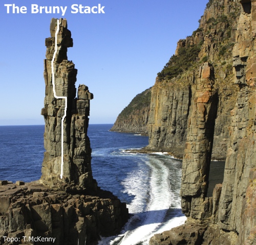
Photo of Monument is courtesy of Joe Shemesh and Bruny Island Charters.
The Monument, rearing out of the sea and topped by a coronet of blocks, is a spectacular finger of rock, about 45m high and apparently precariously balanced. Opposite on the mainland is the smaller pillar, the Fickle Finger (of Fate).
A climb that was a long time in the making, over four years from when it was first mooted! The wave- cut platform that forms the base is littered with fallen blocks which attest to both the ferocious force of the wind and storm waves and to the quality of some of the rock. A helmet is strongly recommended. Start in the centre of the north face, taking the middle line with a small roof at mid-height. Climb the short wall and then follow the crack to the loose roof. Move R to a wider crack, which is climbed for a metre or so until moves can be made L over the roof and back into the crack. Continue up to the "cave" high on the R arête, step L and climb the main face to finish between the blocks of the coronet. The large block to the R seems most stable for an abseil descent.
Phil Robinson and Tony McKenny, Glen Kowalik (Skipper) and Jane Monaghan (First Mate), May 2008.
The Fickle Finger
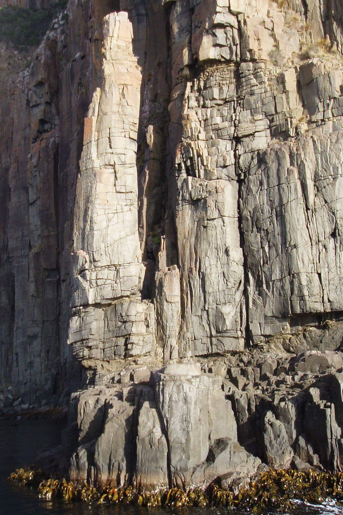
A perfect micro adventure. Launching boat from Tinderbox, the first ascent was climbed in four hours car to car. The route takes the line of least resistance to the summit and is mostly of excellent rock with enjoyable climbing. The summit however is barred by some extremely dubious rock, which one must levitate past. Simul rap from top with care.
S. Bischoff, D. Darren, Nov 2016.