
Gordon Gorge
Acknowledgement
By Hamish Jackson
Introduction
Spectacular cliffs line both sides of the upper Gordon gorge, where the Gordan River cuts between the Denison Range and The Thumbs, running it’s course from Lake Rhona to Lake Gordon. The section of cliff dropping into the gorge from the ‘Packers spur’ at the northern end of the Thumbs consists of very good quality rock for climbing. The rock type is known as Siliclastic sandstone conglomerate (Owen group and Gordon group) - a rare rock type for Tasmania, that is in many sections virtually identical to the rock at Arapiles. The rock is very different to the rock at the nearby Adamsfield boulders, with most of the cliff having very few if any pebbles. The rock at the Cliffs of Insanity is diferent again, with a more conglomerite-quartzite in feel, but similarly steep!
It is important to emphasise from the start that this cliff is a very remote and totally wild package - even by Tasmanian standards - and it features exposed and overhanging climbs. Backing off such an overhanging route could be rather challenging and costly due to left gear! Furthermore, there is no track here - so significant experience in off track navigation and path finding are needed. The approach is flat-ish, but somewhat arduous. Overall, the cliff is only suitable for very experienced trad climbers with associated bushwalking experience. the editor recommends potential parties 'check their credentials' to reduce the chance of a taspol rescue - for example it would be best to tackle some more accessible wilderness cliffs before coming here, such the sentinels, the needles, the Geryon traverse.
The area lies within the TWWHA and outside the listed hand drill exception areas, so this means bolting without a permit is against the law. Happily, the climbing here is unique for Tasmania as the rock accepts a lot of good gear even on relatively improbable sections of face, and is typically over-hanging with climbing easily than expected. This means solid trad routes have been approachable ground up, on sight with no cleaning, even through fairly blank looking face climbing sections! The fact the climbs are steep does mean a confident leader approach is required as it gets pretty pumpy placing unnecessary, closely spaced gear (potential falls are typically very clean and safe). Another unique aspect for Tassie climbing is the size of the cliffs situated above the river, making for remarkably atmospheric gorge climbing and lovely camping with swims etc during the summer months.
History
These cliffs have been noticed from afar by many kayakers and bushwalkers and probably some climbers over the years. They were first noticed by the Jackson family after they appeared in a ‘Tasmania from the Air’ Calendar in the 1980s. A trip to the summit of Clear Hill and then to the nearby Cliffs of Insanity confirmed the significant climbing potential. Paddlers Peter Rand and Simon Jarman had separately encouraged Hamish to explore the area and shared some inspiring, yet also intimidating, photos of the cliffs from the river. Scaling the cliffs on natural gear looked somewhat improbable from the initial photos.
Bushwalking notes made pre-2019 report that the Gorge rim was always reasonably easily accessed via the Clear Hill plains, and this route became even easier after the 2019 Gell River fires. The first routes were established in early 2024 by Hamish Jackson and Jamie Spencer on their first trip to the Gorge.
Access
The Gorge rim camp is reachable in about six hours from Hobart – 2.5 hours drive and 3 hours walk. The walk is likely to take longer on your first visit. Weekend trips with a Friday afternoon start can be quite productive if you camp on the rim and get water from the last creek crossing.
Road Access:
Access is via Strathgordon 'SW' road, then right onto Clear Hill Road, then right again onto the Morley track, which branches off the Clear Hill Road a few km past Adamsfield cliff parking.
The Morley track is gated about 20-50m after the turn off to the track. The gate key can be obtained from the Mt Field Parks office. The key must be booked online, and collected en route. In late 2026 staff have requested in hours pick up. The key can be dropped into an after hours return box on the way home.
On most trips, we have not got the key and have just ridden a bike for the 2km from the gate to the start of the walk.
From the gate, follow the 2WD access road past the 2 huts to the river crossing. With a bike or AWD/4WD, ford the river (nb pedestrian log crossing 30m downstream from ford) and continue east past the next hut/picnic shelter on the left and along to the start of the walk (see GPS and map points). The start of the walk is about 1km past the river, or 2km total from the gate, so it could also be walked if you don't have a bike or a key.
Walking Route:
There are walkers' pads along clear hill plains (see Abels books), and also historic remnants of the old mining horse 'packing track' that went from Adamsfield to Maydena, which surprisingly went all the way around the northern spur of the Thumbs. However, these tracks are marginal and intermittent, so it is best to think of the cliff access as a pure off-track walking experience, and so make sure you have the necessary route-finding skills. It is hard to get lost in day light hours as the plains are bounded by a range on each side, but it is easy to get into slow terrain if you don't look at the maps properly.
The best routes DO NOT go straight along the middle of plains (too clumpy), but travel on the far eastern side of the plains, on the flanks of the thumbs, where the vegetation is sparse. you should expect to encounter rough creek crossings.
Some Key GPS points are included below, and a rough route is shown on the map - these help avoid the main scrub patches.
Base of cliff:
The best descent route to the WW cliff base starts at the middle of the saddle, then goes diagonally down right for 50m, crossing the scree low down and moving over to the right/eastern edge of the gully. Continue on this RH side down a convenient wombat track.
Camping
The most accessible camping is found on top of the Gorge rim, about 200m west of 'Wild West Buttress', with water found from the creek 5 min back south along the plains. An alternative camp otpion is to decend down the gorge, but the last section of thsis from the cliff base to the river are very rough and strewn with fallen trees.
Ethics and environment
Ethics:
The area lies within the TWWHA and outside the listed hand drill exception areas, so this means bolting without a permit is against the law. Given the wilderness values here are striking and the rock is particularly well suited to trad climbing, the discovery teams propose that in the medium term that this area of the gorge remains a trad area and no permit applications be made. So far a leave no trace style has been readily achievable due to easy walk offs. If you visit the GG and have a different vision for the style that would suit this area, then please contact Crag Steward and the CCT to discuss your views and possible solutions so that climbing access for the whole of TWWHA is considered properly and well managed.
Environment:
Please observe minimal impact camping etiquette - you are in the Tasmanian Wilderness World Heritage Area.
Birds: 🦅 this is a new cliff that has been rarely visited by climbers, or other users/biologists, so it is possible undocumented nest sites are hidden here. It is suitable habitat for Peregrine falcons, so please keep an eye out for possible nest-sites and avoid these July-Jan.
Climbs with likely evidence of peregrines hunting are marked with this symbol: 🦅
The TWWHA is remarkable for some of the oldest Aboriginal heritage sites in Tasmania. AHT have provided a desktop assessment indicating no recorded sites in the vinicity of this climbing area, but please be mindful of unexpected discovery plans (see Code of Conduct). There is well recorded settler heritage in the Adamsfield area, including old mining equipment and huts. Use of these huts requires a booking from Parks.
Access details
Morley Track, Parking, and rough walking route (no track)
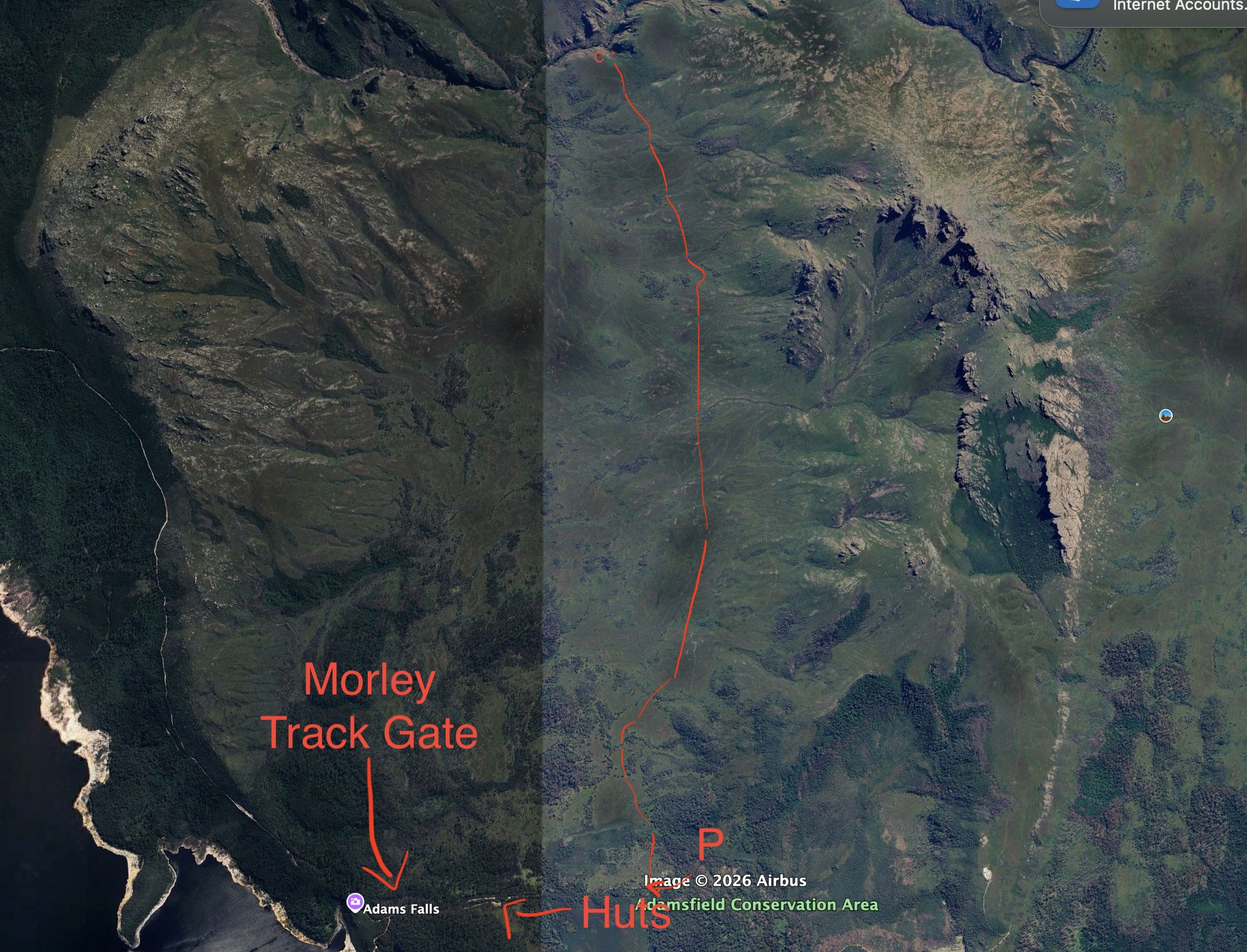
Key GPS points:
Parking spot/start of walk
42 43 09.18S 146 19 29.17E
First scrub band avoided:
42 42 57.08"S 146 19 29.69E
Convenient swimming pool on Abel creek
42 41 11.87S 146 19 46.68E
Travel above last tree band:
42 40 38.83S 146 19 49.79E
Top camp
42 39 39.28S 146 19 12.85E
GPS
Buttress access topo and top camp
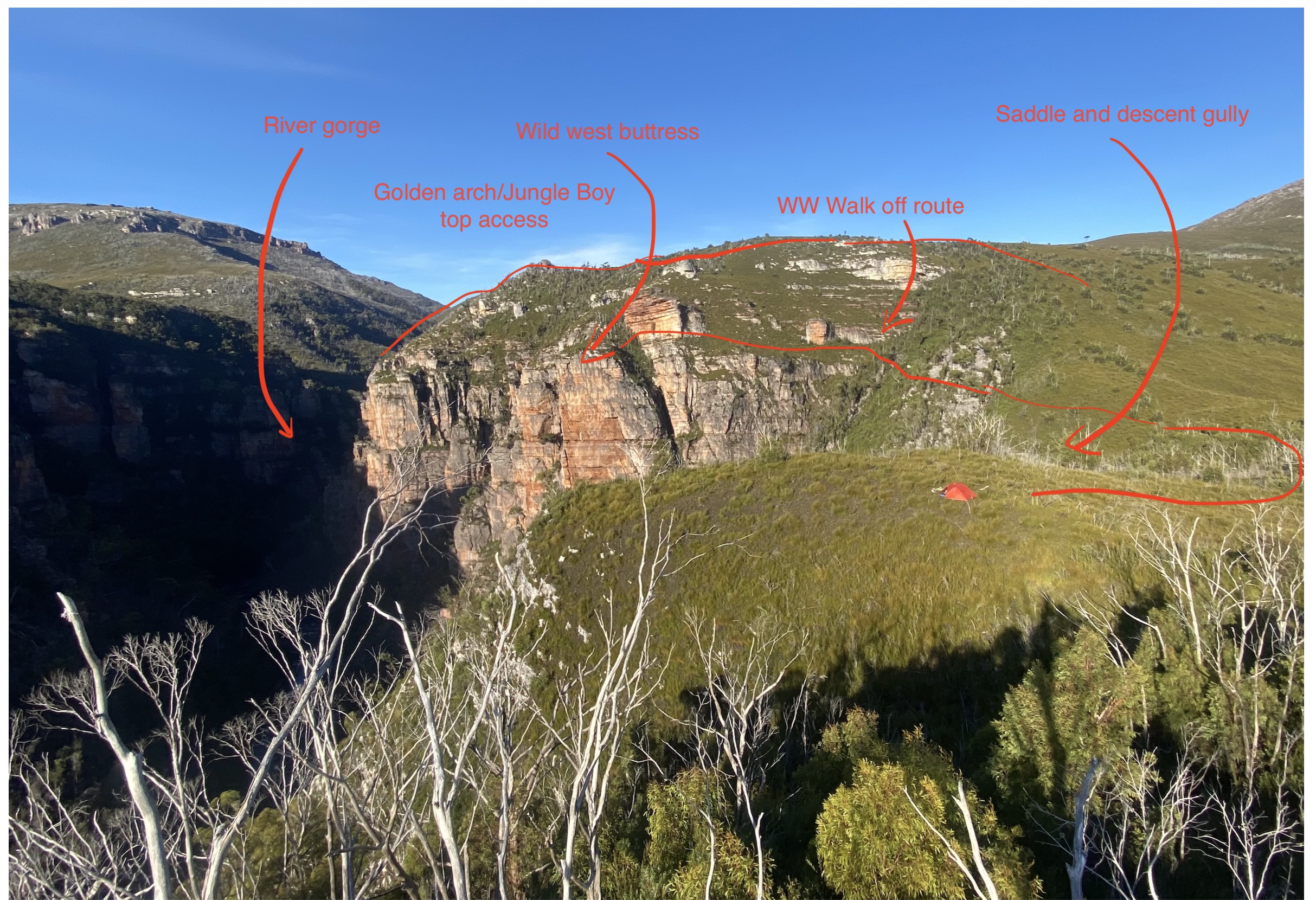
The Golden Arch Buttress
Jungle Boy
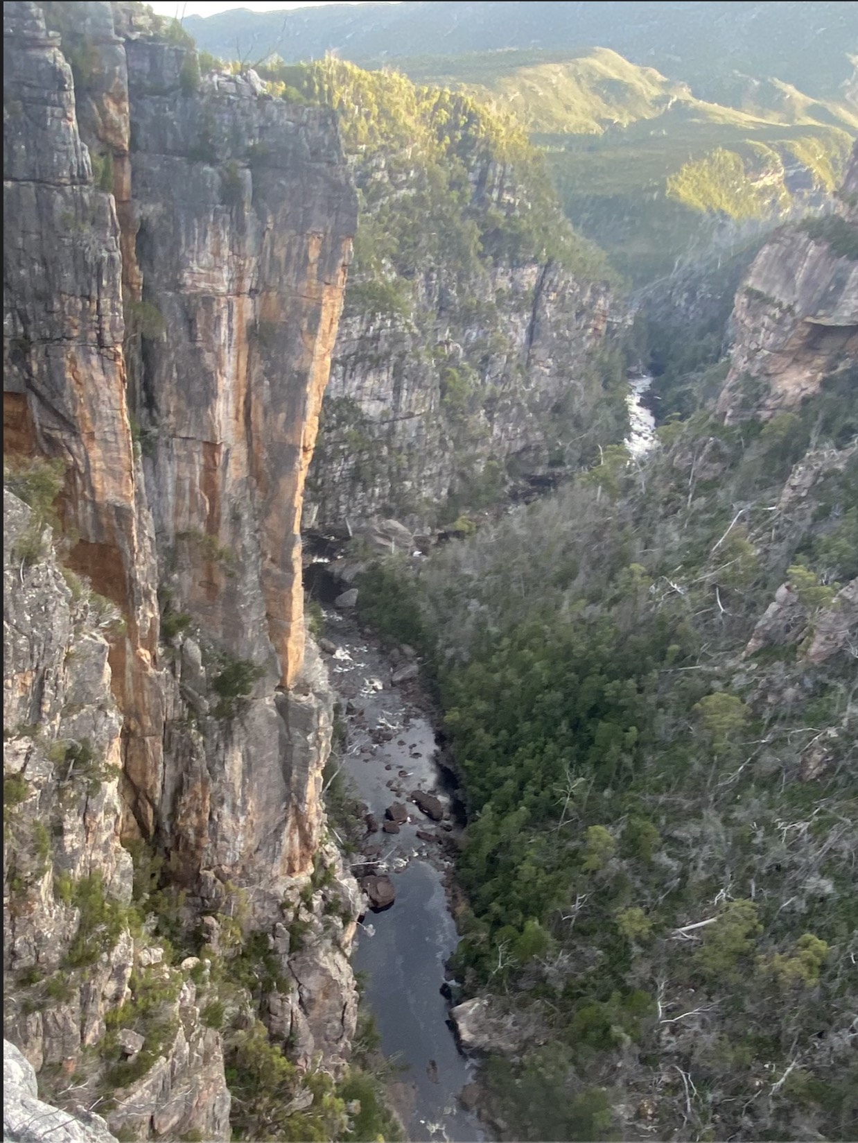
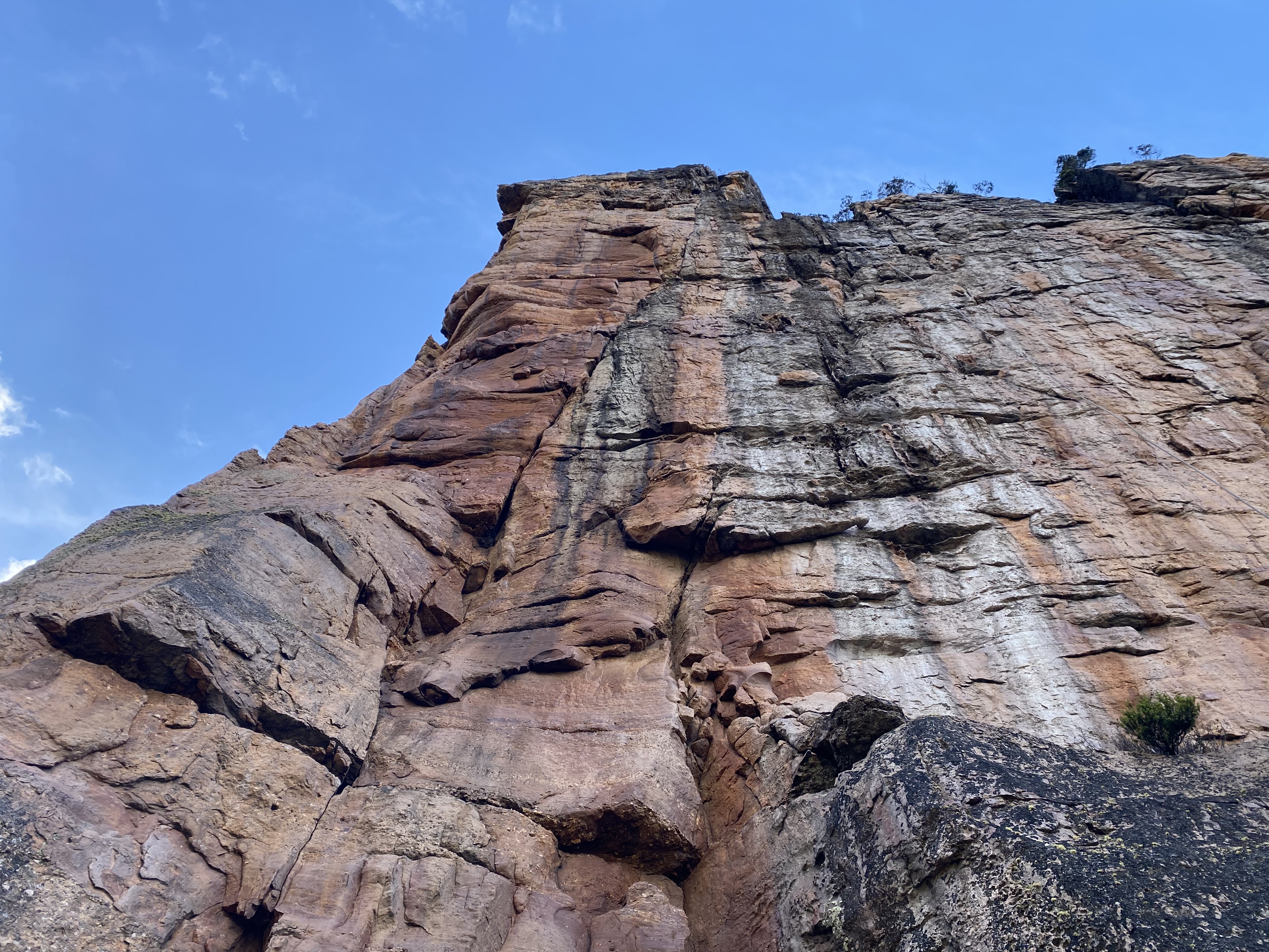
H Jackson and Jem Clemens Jan 2025
Worth a look if you're into steep cracks 4 hours from the road.
Beautiful R leaning weakness up face R of Jungle Boy.
Fix rope from bushes/tree and rap to highest big ledge. Anchor is a long way back from edge, long cord or 60m rope useful.
Up corner R of arete (as per JB p2), then follow diagonal crack into steep terrain. Sneak a rest on some jugs and take pumpy sequence to pencil thin seam and beyond. Traverse up and R to reach ledge and corner (possible belay), and climb face just R of corner or jug fixed line to top.
Carl Hansen, Matt Miller Mar 2026
West of Wild West
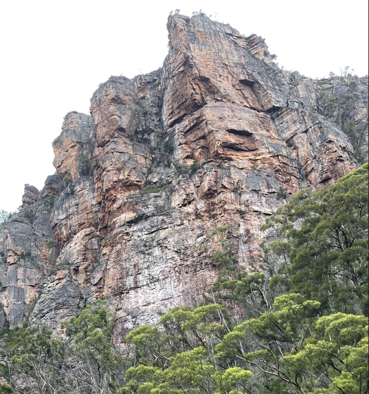
A. Wylie, M. Watkins, E. Henschell, Sept 2026
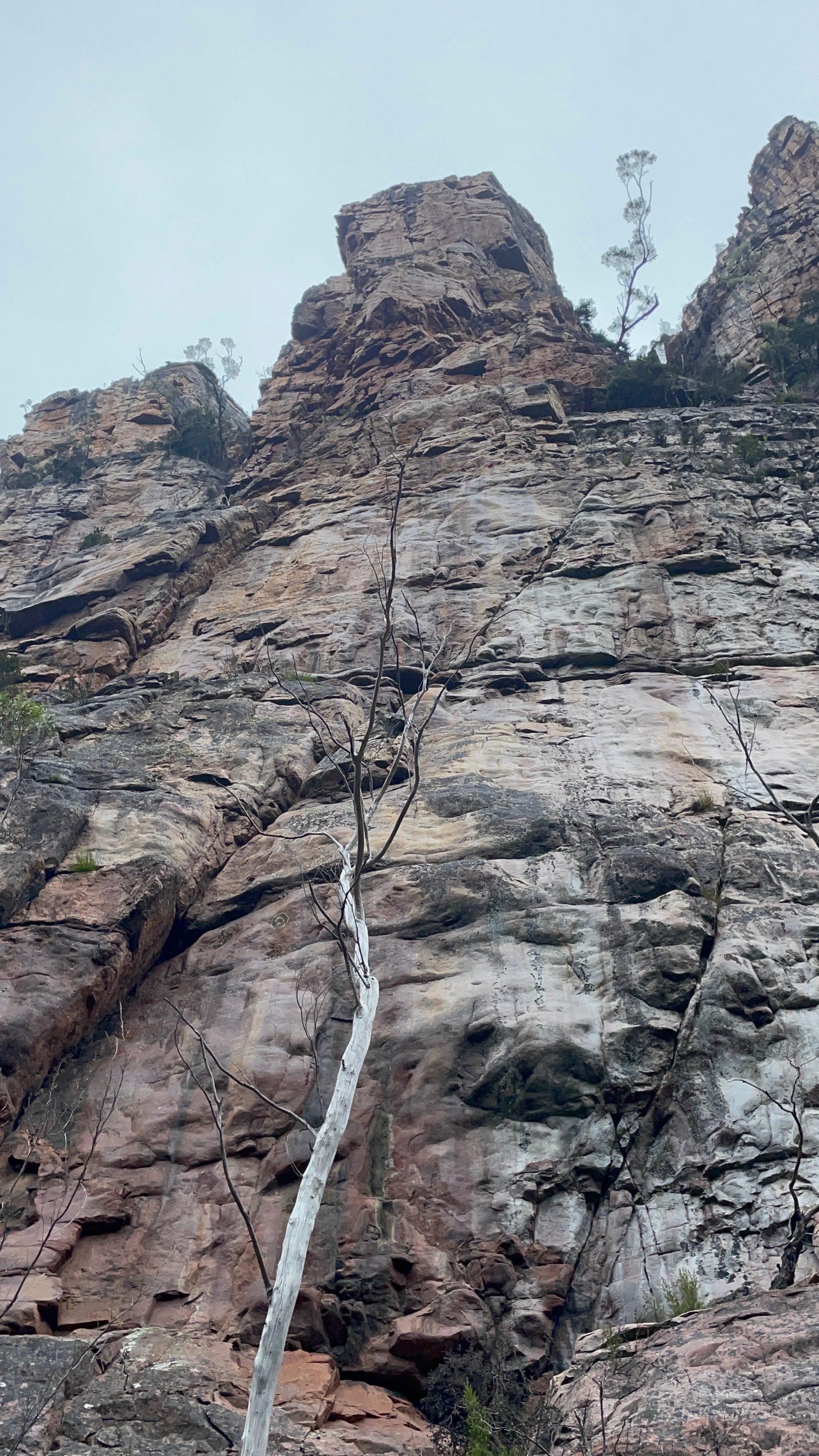
H Jackson, M Blowers and S Joseph Jan 2026.
Jamie Spencer (1,2,4) and H Jackson (3) May 2025
North-east face of WW Buttress 🦅
Jem Clemens and H. Jackson Jan 2025
Wild West Buttress (aka Tyger face)
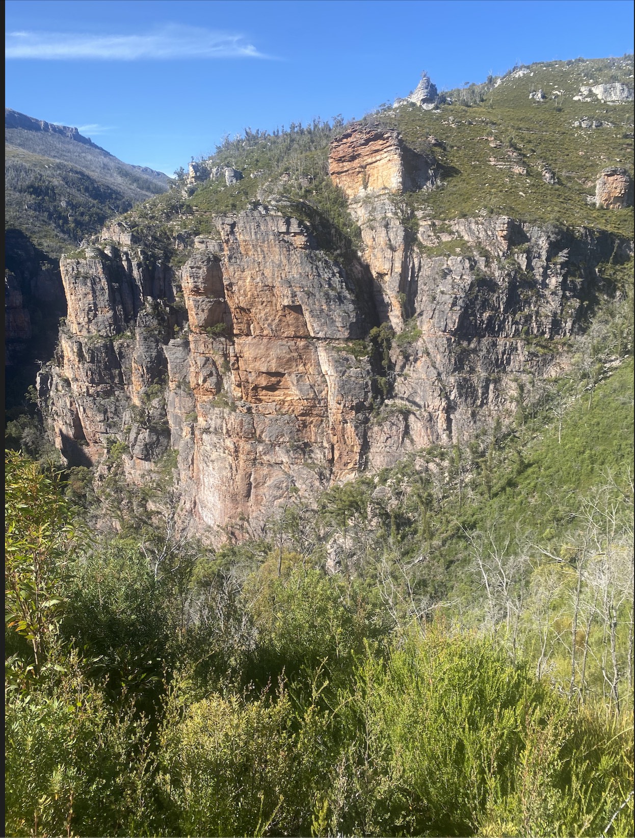
H Jackson and J Spencer Feb 2024
H Jackson, J Spencer and Toby Watkins May 2025
H Jackson, A Wylie, T Watkins 2026.
H Jackson and N Watkins March 2025
Marls and Nic Watkins May 2025
Matt Miller, Carl Hansen Jan 2026
Tiny Tyger Buttress
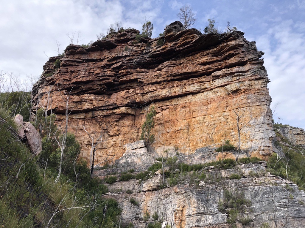
Aim for the big scoop feature. Slightly left on trippy black circle rock then through little roof to a stance. Up through the wormhole via wild karate kick and then up to top and belay on left on nice ledge with gear.
Alex Wylie, Kate Eckhardt April 2026
The jugs are bigger than the roof! Up the crack feature to begin on bomber rock, through the three roofs with increasing size and difficulty. After pulling onto the headwall of the third biggest roof, traverse left via a little cell and finish next to unstable tree. Walk 5m back to a little cave with some gear in the back to use as anchor.
Alex Wylie, Piret May, May 2026
Taby Cat Buttress
Ascends the attractive orange buttress above to the walk off from WW.
A pumpy little number but with more friable rock than main routes. Start just left of the main overhang. Climb steeply up, initially straight then trending right. The gear gets better as you go
Toby Watkins, N and M Watkins May 2025